Skip to content
>

Overlanding Routes Across the American West

ROUTE LIBRARY REVIEWED JULY 10, 2026 · PUBLISHED AND IN-PRODUCTION GUIDES ARE LABELED SEPARATELY

Route Index / Western United States / 2026

Overlanding Routes Across the American West

A practical route library for weekend escapes and multi-day backcountry trips—organized by time, access, vehicle requirements and the decisions that matter before you leave pavement.

01 / Featured Route

Alabama Hills is the current beginner entry point: close to Lone Pine, anchored to a mapped 2WD-accessible designated campsite and supported by clear official planning sources.

Vehicle campsite among rounded granite formations in Alabama Hills with the Sierra Nevada behind it Published Guide

California · Weekend · Beginner

Alabama Hills 2-Day Basecamp Route

One night near Lone Pine, an optional Whitney Portal out-and-back and a final stop at Manzanar. This route is built around a legal designated campsite rather than a generic map pin.

Trip 2 days / 1 night
Mileage 37.2 planned miles
Vehicle 2WD in dry conditions
Camping Free permit required

02 / Route Index

More routes, organized like an editorial field guide

Showing all published and in-production routes.

Remote dirt road through High Rock Canyon in Nevada Published Guide

Nevada · Multi-Day · High Clearance

Black Rock Desert 3-Day Overland Route

Gerlach, Black Rock Playa and High Rock Canyon with two nights off-grid, long no-service stretches and strict dry-surface decision points.

3 days 120–150 mi High-clearance 4WD Remote
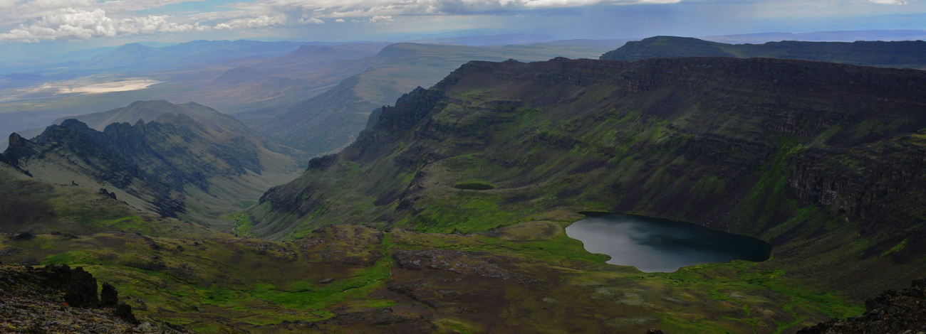
Steens Mountain landscape in southeastern Oregon Guide in Production

Oregon · Multi-Day · Mixed Access

Steens Mountain Backcountry Route

A 2–3 day high-desert mountain loop planned around Frenchglen, major overlooks and seasonal access on the Steens Mountain Loop Road.

2–3 days Seasonal Mixed access
Guide in production BLM source
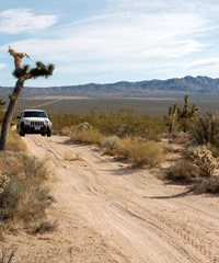
Four-wheel-drive vehicle traveling on the Mojave Road Guide in Production

California · Multi-Day · High Clearance

Mojave Road 3-Day Overland Route

A historic desert traverse planned around NPS road guidance, undeveloped camping, dry-lake hazards and high-clearance 4WD preparation.

3 days About 150 mi High-clearance 4WD
Guide in production NPS source
No route currently matches this filter.

03 / Browse by Style

Choose by the kind of trip you are actually planning

Route categories are based on time, remoteness and road complexity—not only mileage.

01

Weekend Routes

One- or two-night trips with clearer staging, nearby services and practical exit options.

02

Multi-Day Routes

Trips requiring multiple nights, deliberate fuel planning and stronger bailout decisions.

03

Beginner Routes

Lower-complexity access, fewer technical sections and shorter distance from services.

04

High-Clearance Routes

Rough, remote, sandy or rocky sections where tires, clearance and recovery planning matter.

04 / Compare

Compare the current route library at a glance

This table helps users and search engines understand the main differences without opening every guide.

Route Status Duration Vehicle Complexity Primary risk Guide
Alabama Hills Published 2 days / 1 night 2WD in dry conditions Beginner Heat, campsite availability View route
Black Rock Desert Published 3 days / 2 nights High-clearance 4WD Moderate Wet playa, remoteness View route
Steens Mountain In production 2–3 days Mixed; high clearance on rough sections Moderate Seasonal closure, weather Official source
Mojave Road In production About 3 days High-clearance 4WD Moderate–advanced Deep sand, dry lakes, isolation Official source

05 / Verification

How CIWILD reviews route information

Official facts, planning calculations and field-verification status are kept separate.

01

Start with the land manager

BLM, NPS, USFS and local agency pages are prioritized for access, permits, closures and safety.

02

Separate fact from calculation

Agency-published facts are distinguished from CIWILD mileage totals and trip-planning estimates.

03

Label publication status

Unfinished routes remain clearly marked and do not link to incomplete CIWILD pages.

04

Show the review date

Readers can see when rules, fees, roads and closures were last checked.

05

Disclose field verification

Source review and an independently field-driven itinerary are not treated as the same thing.

06

Link to live alerts

Fast-changing road, weather and fire information stays with the authoritative agency source.

07 / FAQ

Route planning questions

What information is included in a CIWILD route?

Published routes aim to include mileage, vehicle requirements, legal camping, permits, seasonal risks, fuel and water planning, emergency details and official source links.

Which route is best for beginners?

Alabama Hills is the current beginner choice because it stays close to Lone Pine and uses a mapped 2WD-accessible designated camping anchor.

Do all routes require four-wheel drive?

No. Alabama Hills is planned around 2WD access, while Black Rock Desert and Mojave Road require substantially more remote-road preparation.

Why are unfinished routes visible?

They show the editorial pipeline without creating dead or incomplete CIWILD pages. Each one links only to its responsible public agency.

Need one campsite, not a complete route?

Use the campsite directory to compare individual locations by state, road access and camping type.