
D1
Colorado River to the eastern Preserve
Start with a full tank and complete supplies in Needles.
- Colorado River-side approach
- Piute Spring and Fort Piute corridor
- Lanfair Valley transition
- Camp only in a previously used legal site
Historic 4WD crossing · California
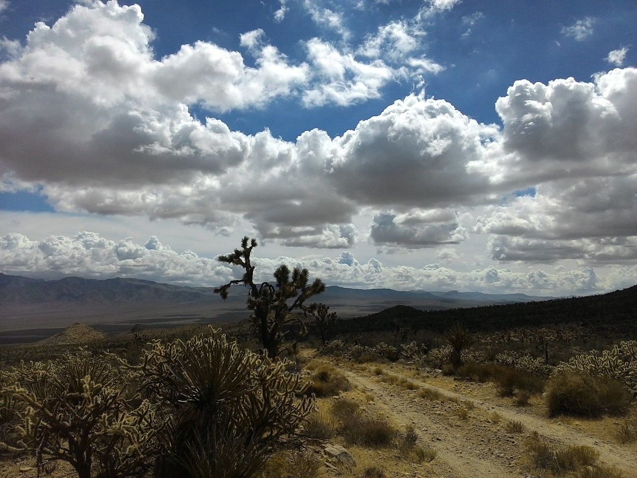
A roughly 150-mile east–west route between the Colorado River and the Mojave River, following an Indigenous travel corridor and later military road through Mojave National Preserve.
Public-source planning guide · NPS road, camping and fire information checked July 15, 2026

Fuel, groceries, lodging, Route 66 context and final vehicle checks before entering from the Colorado River side.
Western gateway + campground Afton CanyonVerified BLM campground details, water limitations, passenger-car access limits and the western approach to the route.
Read this first
Exact mileage varies with the selected endpoints, detours and current closures. This page deliberately avoids publishing unverified mile-by-mile directions. Use the official NPS map, current road report and a dedicated Mojave Road guide or verified GPX track.
Example itinerary
NPS says a complete crossing usually requires three days. The sequence below is a planning outline, not a navigation log, and assumes the full road is open and dry enough to travel.
Start with a full tank and complete supplies in Needles.
Continue through the central Preserve while watching for sharp rock, washouts, sand and route intersections.
Cross Soda Dry Lake only when the official road is open and conditions are firm, then exit through the western canyon corridor.
Landmark sequence
These locations are useful for understanding the route’s history and terrain. They are intentionally shown without unofficial mile markers.
The historic route links the Colorado River with the Mojave River. Needles is the practical modern service base for an eastern approach.
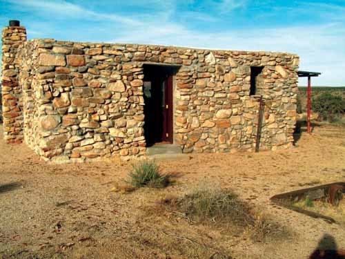
A narrow riparian corridor and the remains of a military outpost occupied in 1866–1867. The access is rough, and camping is prohibited within one-half mile of the fort.
An open valley section connecting the eastern route with the central Preserve. Expect long distances, route intersections and changing surface conditions.
One of the springs that formed a natural travel corridor across the desert. NPS interpretation also covers Camp Rock Spring and the route’s Indigenous and military history.
Higher-elevation terrain with washboard, bumps and the possibility of storm damage. Use current NPS road conditions rather than fixed historical descriptions.
The lakebed is never completely dry below the surface. Stay on the compacted Mojave Road; leaving it is illegal, damages wilderness and greatly increases the risk of becoming stuck.
The western canyon gateway lies on BLM land outside Mojave National Preserve. The developed campground has separate BLM fees and rules.
Vehicle + recovery
NPS currently requires high clearance, heavy-duty tires and a 4L low-range transfer case for safe Mojave Road travel.
Vehicles inside Mojave National Preserve must be street legal in California. ATVs, UTVs, side-by-sides, sand rails and similar non-street-legal vehicles are prohibited.
NPS recommends not attempting the road alone. A second vehicle provides recovery support when one vehicle becomes stuck or disabled.
Inspect tires, oil and fuel before departure. Carry a suitable jack, recovery points, tow equipment, spare tires, tools, extra water and vehicle fluids.
NPS warns against relying solely on automated GPS directions. Bring a paper map and verify the route before leaving pavement.
Do not drive around washouts, barricades or wet lakebed sections. Off-route damage may result in citations and financial liability for restoration.
Camping rules
Before choosing an overnight stop, review the Mojave Road dispersed camping guide for primitive-site expectations, campsite selection, stay limits, water-source setbacks, paved-road restrictions, and current campfire guidance.
| Topic | Verified rule | Planning implication |
|---|---|---|
| Entrance and registration | Mojave National Preserve does not require an entrance pass. There is no registration fee for the Mojave Road. | Developed campground fees and separate BLM site fees may still apply. |
| Primitive campsite selection | Use previously used or disturbed sites outside posted closures. Creating new campsites or driving off established roads is prohibited. | Do not widen a site, crush vegetation or pull into undisturbed desert. |
| Water-source setback | Campsites must be more than 200 yards from natural or constructed water sources. | Springs and wildlife water infrastructure are not campsites. |
| Stay limit | Maximum 14 consecutive days per stay and 30 total camping days per calendar year in the Preserve. | This is a route trip, not a long-term base-camping zone. |
| Fort Piute | Camping is prohibited within one-half mile of Fort Piute and its access corridor. | Select a legal existing site farther from the historic and riparian area. |
| Human waste | NPS currently allows catholes 4–6 inches deep, at least 200 feet from water, camp and trails. Toilet paper and hygiene products must be packed out. | A portable toilet or WAG-bag system remains the lower-impact option for vehicle groups. |
| Large groups | More than 7 vehicles or 25 people requires a Special Use Permit. | Allow agency processing time before organizing a large group crossing. |
| Fire status | As checked July 15, 2026, open fires and charcoal grills are prohibited. Controlled gas appliances with shutoff valves are allowed. | Recheck the live order because fire restrictions change seasonally. |
Fuel, water + facilities
There is no fuel or food sold inside Mojave National Preserve. Official water facilities exist in the Preserve, but they are not guaranteed route-side resupply points.
| Need | Verified information | Best practice |
|---|---|---|
| Eastern fuel and lodging | Needles has full services and a 24-hour hospital emergency department. Gateway guide available | Review the Needles gateway guide and leave town with a full tank. |
| Western fuel and lodging | Barstow has full services and a 24-hour hospital emergency department. | Use Barstow as the western resupply and recovery base. |
| Fuel inside the Preserve | No gasoline is sold in Mojave National Preserve. | Carry a reserve based on your vehicle, detours and recovery margin. |
| Food | No food or beverages are sold inside the Preserve. | Carry the full trip supply plus delay food. |
| Potable water facilities | NPS currently lists water at the Kelso Depot bathhouse, Hole-in-the-Wall Information Center and Hole-in-the-Wall Campground. | These are not a substitute for carrying all required drinking and emergency water. |
| Kelso Depot status | The indoor visitor center is temporarily closed. Outdoor restrooms, parking and water filling are currently available. | Use Hole-in-the-Wall Information Center for current in-person visitor services. |
| Afton Canyon Campground | BLM’s 22-site campground is first-come, currently $6 per night, and has separate BLM rules. Western gateway | Check the Afton Canyon guide. |
| Cell signal | Cell coverage is unreliable or nonexistent across most of the Preserve. | Use offline navigation and carry satellite communication when possible. |
Emergency planning
Straight-line distance is not useful in this terrain. Road damage, closures and the direction of travel may determine whether Needles or Barstow is the practical evacuation side.
| Facility / contact | Verified details | Use |
|---|---|---|
| Colorado River Medical Center | 1401 Bailey Avenue, Needles, CA 92363 Main: 760-326-7100 Emergency room listed as open 24/7 |
Eastern-end hospital reference. |
| Barstow Community Hospital | 820 E. Mountain View Street, Barstow, CA 92311 Main: 760-256-1761 Emergency Department: 760-957-3030 Emergency room open 24/7 |
Western-end hospital reference. |
| Mojave National Preserve | General information: 760-252-6100 For emergencies, NPS instructs visitors to dial 911. |
Road, facility and Preserve information—not a substitute for emergency dispatch. |
| Trip contact at home | Leave route direction, vehicle descriptions, passenger names, planned camps and a missed-check-in action time. | Essential because cell coverage is unreliable and there is no route registration system. |
Frequently asked
NPS describes the route as roughly 150 miles. A complete crossing usually requires about three days.
Yes for a responsible full-route plan. Current NPS conditions classify it as 4WD only and call for high clearance, heavy-duty tires and low range.
NPS specifically states that the route is not appropriate for all-wheel-drive SUVs under current conditions.
There is no general route registration fee or backcountry-camping registration system. More than 7 vehicles or 25 people requires a Special Use Permit.
Yes inside Mojave National Preserve, provided you use a previously disturbed legal site and follow distance, closure and stay-limit rules. Developed campground fees are separate.
Do not assume so. The subsurface remains moist and the route can become impassable. Use the live NPS road report and never drive around the established road.
As verified July 15, 2026, open fires and charcoal grills are prohibited in Mojave National Preserve. Recheck the official restriction immediately before travel.
Verification record
Start with Needles for the eastern service base or review Afton Canyon for the western campground and exit.
For broader trip planning, return to the California dispersed camping guide or compare other CIWILD overlanding routes.
To find a different overnight base, browse the Top 100 free camping directory or explore the campsite map.